
Scientific Data
Publicly available, free, online scientific data, largely from university, industry, and government research programs.
353 listings
 Submitted Mar 07, 2005 to Scientific Data HMDC is the principal distributor of quantitative social science data from major international data consortia for Harvard and MIT, and a world leader in research in digital libraries and statistical methodology. HMDC also provides computer support to several of Harvard's social science departments, research centers, and schools, and maintains a popular fellowship program for visiting graduate students
|
 Submitted Mar 02, 2005 to Scientific Data This database from the Population Reference Bureau contains data on 95 demographic variables for more than 220 countries, 28 world regions and sub-regions, the world as a whole, the United States as a whole, and the U.S. states. (Not all countries have data on all variables.)
|
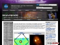 Submitted Feb 18, 2005 to Scientific Data This web site is for scientists and astronomy enthusiasts seeking actual data from a multitude of space-based observatories. HEASARC is the primary archive for high-energy astronomy missions, in the extreme ultraviolet, X-ray and gamma-ray wavelengths. On this site, you'll find archival data, multi-mission software and analysis tools, and information about current and past observatory missions. These are all available freely for your use.
|
 Submitted Feb 17, 2005 to Scientific Data The NOSA Web site was designed to provide information that is useful both to the managers of observing systems within NOAA and to the user who wants to know more about NOAA's mission and the environmental parameters it is monitoring and where. The main focus of the site is the Featured Observing System. Each month a NOAA Observing System will be featured with a description and links to the site for the user to learn more about that system. The left-hand side of the new Web site contains detailed information about the NOSA project and related documents, which describe architecture, programs, and requirements for the projects and the observing systems. The geospatial information of more than 80 of these observing systems was collected into a geospatial database with the assistance of the observing system managers. This database forms the basis for the geospatial capabilities of the Web site.
|
|
Submitted Feb 15, 2005 to Scientific Data Select an earthquake's Description of Location to show the location of that earthquake on a map. Click on globe image to see all quakes on a world map.
|
 Submitted Feb 08, 2005 to Scientific Data This page provides access to cruise information and data collected during Ridge 2000 funded projects. Learn more about this web site by browsing the What's New page, and reading other Project Related Documents.
|
 Submitted Jan 09, 2005 to Scientific Data New Madrid region earthquake (seismic) data from the Center for Earthquake Research and Information.
|
 Submitted Jan 05, 2005 to Scientific Data A searchable directory of images, visualizations, and animations of the Earth. The purpose of NASA's Visible Earth is to provide a consistently updated, central point of access to the superset of NASA's Earth science-related images, animations, and data visualizations. These images are considered to be public domain and, as such, are freely available to the interested public-at-large, the media, scientists, and educators for re-use and/or re-publication.
|
 Submitted Dec 31, 2004 to Scientific Data Satellite images of Indonesia and Sri Lanka before and after the December 26, 2004 earthquake and tsunami from Digital Globe.
|
 Submitted Dec 30, 2004 to Scientific Data The most recent South Pole ozone data. Historical South Pole ozone data. Ozone mixing ratio and ambient temperature vs. altitude and time (1991 to present). Other information about the ozone hole. Historical ozone hole animations.
|
 Submitted Dec 29, 2004 to Scientific Data Images are processed by the NASA Space Telescope Science Institute. View by year from 1990 to 2004. View by subject: solar system, stars, star clusters, supernovae, nebulae, quasars, active nuclei, exotic, blackholes, galaxies, greatest hits.
|
 Submitted Dec 29, 2004 to Scientific Data Real-time weather forcasts. Climatological and historical analyses. Customize your own images. Access data via GDS. Aceess data via live access server. Sponsored by the Center for Ocean-Land-Atmosphere Studies in Calverton, Maryland.
|
|
Submitted Dec 28, 2004 to Scientific Data See a computer simulation of the tsunami created by the Sumatra submarine earthquake.
|
 Submitted Dec 28, 2004 to Scientific Data The Physical Oceanography Distributed Active Archive Center (PO.DAAC) is responsible for archiving and distributing data relevant to the physical state of the ocean. Most of the products available at the PO.DAAC were obtained from satellites and are intended for use in oceanographic and interdisciplinary scientific research. Please refer to the on-line data catalog for a listing of available PO.DAAC data products, tools, and services. All PO.DAAC holdings are free of charge to scientists, educators and the community at large. The catalog includes data on ocean surface topography, ocean vector winds, sea surface temperature, atmospheric moisture, brightness temperature, climatology, gravity, heat flux, ice (land/sea), in-situ, multi-parameter, and scatterometer sigma-0.
|
 Submitted Dec 28, 2004 to Scientific Data TAO provides real-time data from moored ocean buoys for improved detection, understanding and prediction of El Nino and La Nina. The TAO array (renamed the TAO/TRITON array on 1 January 2000) consists of approximately 70 moorings in the Tropical Pacific Ocean, telemetering oceanographic and meteorological data to shore in real-time via the Argos satellite system. The array is a major component of the El Ni�/Southern Oscillation (ENSO) Observing System, the Global Climate Observing System (GCOS) and the Global Ocean Observing System (GOOS).
|
 Submitted Dec 27, 2004 to Scientific Data Discriptions of major historical earthquakes in the United States since 1755 from the US Geological Survey. The first recorded major earthquake occurred in Cape Ann, Massachusetts, 1755.
|
 Submitted Dec 26, 2004 to Scientific Data The study of geomagnetism is one of the oldest of the geophysical sciences. Since before the publication of William Gilbert's De Magnete in 1600, people have tried to unravel the mysteries of Earth's magnetic field.The National Geophysical Data Center maintains archives of geomagnetic data to further the understanding of Earth magnetism and the Sun-Earth environment. Data at NGDC include surface, ocean, airborne and satellite measurements, as well as models of the main field and its secular change, and models of the Space - Earth environment. Data on Earth's ancient magnetic field are available from archeomagnetic and paleomagnetic measurements. For those interested in learning more about geomagnetism, we have a general information page and a Frequently Asked Questions (FAQ) page. For students studying about geomagnetism, NGDC hosts some useful computer programs, as mentioned in Introduction to Geomagnetic Fields by W. Campbell (Cambridge University Press, 2nd Ed. 2003).
|
 Submitted Dec 20, 2004 to Scientific Data Our goal is to enable users to locate and obtain access to Earth science data sets and services relevant to the global change and Earth science research. The GCMD database holds more than 15,000 descriptions of Earth science data sets and services covering all aspects of Earth and environmental sciences. One can use the search box or select from the available keywords to search for data and services. We encourage your participation in writing and maintaining the information in our databases and you will find authoring tools to assist you. Subscription services are available to notify you of new entries. The Interoperability Forum is available to discuss content and database issues.
|
 Submitted Dec 07, 2004 to Scientific Data The data included in the Department of Energy's Fuel Economy Guide are the result of vehicle testing done at the Environmental Protection Agency's National Vehicle and Fuel Emissions Laboratory in Ann Arbor, Michigan and by vehicle manufacturers themselves with oversight by EPA. All of the data files are comma delimited text files for import into database or spreadsheet tables. The 1998, and 1999, are also available as an excel spreadsheet. The data files have been compressed. A utility such as PKUNZIP can be used to decompress the files. Recent editions of the Fuel Economy Guide are provided as Adobe Portable Document Format (PDF) files.
|
 Submitted Nov 23, 2004 to Scientific Data ChemFinder.Com is a portal of free and subscription scientific databases. ChemFinder has been providing free chemical searching to hundreds of thousands of scientists since 1995. ChemINDEX, adds power user features to this popular search engine.
|