
Scientific Data
Publicly available, free, online scientific data, largely from university, industry, and government research programs.
353 listings
 Submitted Oct 29, 2004 to Scientific Data Welcome to Envirofacts, your one-stop source for environmental information. Topics: waste, water, toxics, air, land, radiation, compliance, maps, superfund sites.
|
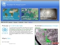
 Submitted Oct 21, 2004 to Scientific Data The Global Hydrology Resource Center (GHRC) provides both historical and current Earth science data, information, and products from satellite, airborne, and surface-based instruments. The GHRC acquires basic data streams and produces derived products from many instruments spread across a variety of instrument platforms. The GHRC is supported by NASA and is the data management and user services arm of the Global Hydrology & Climate Center (GHCC) in Huntsville, Alabama. Space-based lightning observations are obtained from the Lightning Imaging Sensor (LIS), the Optical Transient Detector (OTD, 1995-2000), and surface validation networks in the continental U.S. and Brazil. Global hydrological parameters such as sea surface temperature, atmospheric water vapor, wind direction, and atmospheric temperature, are derived from several passive microwave instruments aboard the Tropical Rainfall Measuring Mission (TRMM), NOAA-15, NOAA-16, and Special Sensor Microwave Imager (SSM/I) satellites. The GHRC is the host of the Passive Microwave Earth Science Information Partner (PM-ESIP), providing measurement of maximum tropical cyclone wind speeds, global tropospheric and atmospheric temperatures, and observations of tropical rainfall, sea surface temperature, and wind speed. The Convection and Moisture Experiment (CAMEX) archive provides data from the 1998 CAMEX-3 field experiment and has just completed the CAMEX-4 field experiment in Jacksonville Florida (August-September, 2001). CAMEX experiments produce high-resolution spatial and temporal information of hurricane structure, dynamics, and motion.
|
 Submitted Oct 21, 2004 to Scientific Data ChEssBase is a dynamic relational database available online since the summer of 2004. The aim of ChEssBase is to provide taxonomical, biological, ecological and distributional data of all species described from deep-water chemosynthetic ecosystems, as well as images, bibliography and information on the habitats. These habitats include hydrothermal vents, cold seeps, whale carcasses, sunken wood and areas of minimum oxygen that intersect with the continental margin or seamounts. For more information on these ecosystems and their fauna, please visit the ChEss web site: www.soc.soton.ac.uk/chess.
|
 Submitted Oct 21, 2004 to Scientific Data ODP log data fall into two categories. (1) Conventional logs: electrical, density, porosity, gamma ray, and acoustic (not waveforms) data. (2) Other logs: Formation MicroScanner (FMS), Geologic High Resolution Magnetic Tool (GHMT), and Temperature data. Conventional logs are generally sent via satellite to LDEO-BRG for immediate processing; other data are processed post-cruise. Additional data collected with specialty tools such as the Borehole Televiewer, VSP etc. do not undergo routine processing. Processed conventional logs are available on-line through the ODP Logging Services web site at http://www.ldeo.columbia.edu/BRG. The web site offers a catalog of all the log data available in the LDEO-BRG archive, as well as forms to request data not currently available on-line. Shipboard party members are informed of the availability of the processed conventional data from their leg shortly after the end of the leg.
|
 Submitted Oct 16, 2004 to Scientific Data The World Data Center (WDC) system was created to archive and distribute data collected from the observational programs of the 1957-1958 International Geophysical Year. Originally established in the United States, Europe, Russia, and Japan, the WDC system has since expanded to other countries and to new scientific disciplines. The WDC system now includes 52 Centers in 12 countries. Its holdings include a wide range of solar, geophysical, environmental, and human dimensions data. These data cover timescales ranging from seconds to millennia and they provide baseline information for research in many ICSU disciplines, especially for monitoring changes in the geosphere and biospheregradual or sudden, foreseen or unexpected, natural or man-made.
|
 Submitted Oct 16, 2004 to Scientific Data The National Climatic Data Center (NCDC) is the world's largest active archive of weather data. NCDC's mission is to manage the Nation's resource of global climatological in-situ and remotely sensed data and information to promote global environmental stewardship; to describe, monitor and assess the climate; and to support efforts to predict changes in the Earth's environment. This effort requires the acquisition, quality control, processing, summarization, dissemination, and preservation of a vast array of climatological data generated by the national and international meteorological services. NCDC's mission is global in nature and provides the U.S. climate representative to the World Meteorological Organization, the World Data Center System, and other international scientific programs. NCDC also operates the World Data Center for Meteorology, Asheville.
|
 Submitted Oct 16, 2004 to Scientific Data Global Runoff Data Centre (GRDC) the digital world-wide repository of discharge data and associated metadata in support of Global Change Research and Integrated Water Resources Management.
|
 Submitted Oct 16, 2004 to Scientific Data This database contains 39,866 records of specimens in the Invertebrate Paleontological collections at The Academy of Natural Sciences. The collection houses about 105,000 lots. Most of the type collection is listed in this database.
|
 Submitted Oct 16, 2004 to Scientific Data The Reciprocal Net is a distributed database used by research crystallographers to store information about molecular structures. Much of this data is also available to the general public. Reciprocal Net is the home of the Common Molecules Collection.
|
 Submitted Oct 14, 2004 to Scientific Data SEDAC focuses on human interactions in the environment. SEDAC is one of the Distributed Active Archive Centers (DAAC's) in the Earth Observing System Data and Information System (EOSDIS) of the U.S. National Aeronautics and Space Administration (NASA). SEDAC's mission is to develop and operate applications that support the integration of sociaeconomic and Earth science data and to serve as an "Information Gateway" between the Earth and social sciences.
|
 Submitted Oct 14, 2004 to Scientific Data GPW version 2 provides estimates of the population of the world in 1990 and 1995, both population counts (raw counts) and population densities (per square km). National figures have been reconciled to be consistent with United Nations population estimates for those years; unadjusted data are also available. Both images and data are accessible and downloadable.
|
 Submitted Oct 14, 2004 to Scientific Data The Center for International Earth Science Information Network (CIESIN) is a center within the Earth Institute at Columbia University. CIESIN works at the intersection of the social, natural, and information sciences, and specializes in on-line data and information management, spatial data integration and training, and interdisciplinary research related to human interactions in the environment.
|
 Submitted Oct 13, 2004 to Scientific Data The mission of the Agency for Toxic Substances and Disease Registry (ATSDR), as an agency of the U.S. Department of Health and Human Services, is to serve the public by using the best science, taking responsive public health actions, and providing trusted health information to prevent harmful exposures and disease related to toxic substances. ATSDR is directed by congressional mandate to perform specific functions concerning the effect on public health of hazardous substances in the environment. These functions include public health assessments of waste sites, health consultations concerning specific hazardous substances, health surveillance and registries, response to emergency releases of hazardous substances, applied research in support of public health assessments, information development and dissemination, and education and training concerning hazardous substances.
|
 Submitted Oct 13, 2004 to Scientific Data A division of the American Chemical Society. CAS Content: the world's largest collection of electronic information for the scientific community including: most authoritative collection of substance information available; worldwide coverage of current and comprehensive patents and journals, plus reactions, chemical catalogs, and regulated chemicals. We provide pathways to published research in the world's journal and patent literaturevirtually everything relevant to chemistry plus a wealth of information in the life sciences and a wide range of other scientific disciplines back to the beginning of the 20th century. Whether you are: beginning a research project, looking for prior art in assessing patentability, uncovering information on other industry participants, providing research support to key decision makers. CAS provides a range of information products to meet your needs.
|
 Submitted Oct 12, 2004 to Scientific Data The Global Ocean Data Assimilation Experiment (GODAE) is a practical demonstration of near-real-time, global ocean data assimilation that provides, regular, complete descriptions of the temperature, salinity and velocity structures of the ocean in support of operational oceanography, seasonal-to-decadal climate forecasts and analyses, and oceanographic research. The GODAE Monterey Server, sponsored mainly by the Office of Naval Research (ONR), is intended to be a principal node in the GODAE architecture.
|
 Submitted Oct 10, 2004 to Scientific Data Academic seismic reflection and refraction data center. Metadata and data from seismic cruises worldwide. The purpose of this project was to organize UTIG seismic reflection data into a modern relational database management system accessible through the Internet. The system is designed principally for academic scientific use. Users include scientists, research staff and students from around the world that have high bandwidth Internet access. The main features include using Excel files to enter and update metadata, which are uploaded into mySQL, a public-domain SQL server, and then PHP scripts query the metadata and directories, creating web pages, displaying images, and providing ftp links.
|
 Submitted Oct 10, 2004 to Scientific Data The North American Node of UNEP GRID, located at the USGS EROS Data Center, is in the forefront of applying information technology tools such as remote sensing, Geographic Information Systems (GIS) and web mapping to address the relationships between the environment and human populations. Utilizing the expert knowledge of staff and visiting scientists, the information created with these tools provide policy-makers a scientific basis for making decisions. GRID Sioux Falls operates in cooperation with UNEP, NASA, USGS, USFS and US EPA and is guided by an advisory committee attended by representatives from Canada, Mexico and the United States.
|
 Submitted Oct 10, 2004 to Scientific Data The GDC manages a database of navigation, magnetics, gravity, single-beam bathymetry and multibeam bathymetry and other data collected on SIO vessels and maintains large holdings of data from other institutions. The Geological Data Center (GDC) at SIO has been continually adding to its digital and analog archives since its formation in 1970. The holdings now include 295 SIO expeditions, and more than 646 cruises legs, covering 2.5 million nautical miles, and contain about 440 GB of digital data.
|
 Submitted Oct 10, 2004 to Scientific Data Janus Web provides access to ODP's Oracle relational database Janus. The database contains 450 tables of ODP's marine geoscience data that are collected onboard the drillship JOIDES Resolution. The database includes paleontological, lithostratigraphic, chemical, physical, sedimentological, and geophysical data for ocean sediments and hard rocks. Janus has been used to collect data since Leg 171A (January 1997). During the first postcruise (moratorium) year, access to proprietary ODP data is only given to scientists who participated on the cruise. Proprietary data are released to the public one year after the end of each cruise. Non-proprietary data such as ODP & DSDP site information are available to everyone. Data collected prior to Leg 171A are being added to Janus as time permits (see Database Overview for available data).
|
 Submitted Oct 10, 2004 to Scientific Data This page provides access to cruise information and data collected during Ridge 2000 funded projects. Learn more about this web site by browsing the What's New page, and reading other Project Related Documents. Study sites: Juan de Fuca Ridge (Endeavour Segment), Lau Basin (Valu Fa Ridge), East Pacific Rise (8-11N Segment).
|