
Details
Generic Mapping Tools (GMT)
|
|
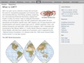
GMT is an open source collection of ~60 tools for manipulating geographic and Cartesian data sets (including filtering, trend fitting, gridding, projecting, etc.) and producing Encapsulated PostScript File (EPS) illustrations ranging from simple x-y plots via contour maps to artificially illuminated surfaces and 3-D perspective views. GMT supports ~30 map projections and transformations and comes with support data such as coastlines, rivers, and political boundaries. GMT is developed and maintained by Paul Wessel and Walter H. F. Smith with help from a global set of volunteers, and is supported by the National Science Foundation. It is released under the GNU General Public License. |
| Submitted by drmoon on Oct 05, 2004 |
| 717 views. Averaging 0 views per day. |
Please login or register if you wish to leave a comment.
Submit
New Links
Most Popular
Quick Search
Statistics
3,012 listings in 21 categories, with 2,274,691 clicks. Directory last updated Sep 12, 2023.
Welcome Amara Fatima, the newest member.
Comments on Generic Mapping Tools (GMT)