
Scientific Data
Publicly available, free, online scientific data, largely from university, industry, and government research programs.
353 listings
 Submitted Jan 07, 2017 to Scientific Data Science.gov searches over 60 databases and over 2200 selected websites from 15 U.S. federal agencies, offering 200 million pages of authoritative U.S. government science information including research and development results. Science.gov is governed by the interagency Science.gov Alliance.
|
 Submitted Jan 05, 2017 to Scientific Data This site is a living database with hundreds of thousands of items digitized from The New York Public Library's collections. New materials are added every day, featuring prints, photographs, maps, manuscripts, streaming video, and more.
|
 Submitted Jan 03, 2017 to Scientific Data A continually growing catalog of publicly available NASA datasets, APIs, visualizations, developer resources, and more.
|
 Submitted Jan 03, 2017 to Scientific Data NASA's Scientific Visualization Studio wants you to learn about NASA programs through visualization. The SVS works closely with scientists in the creation of visualizations, animations, and images in order to promote a greater understanding of Earth and Space Science research activities at NASA and within the academic research community supported by NASA.
All the visualizations and multimedia products created by the SVS, CI Lab, and Goddard Media Studios are accessible to you through this web site, and free to download! Please note that this is not an all-inclusive repository of NASA images and movies. You are welcome to try NASA's Data Portal. |
 Submitted Jan 03, 2017 to Scientific Data The Exoplanet Data Explorer is an interactive table and plotter for exploring and displaying data from the Exoplanet Orbit Database. The Exoplanet Orbit Database is a carefully constructed compilation of quality, spectroscopic orbital parameters of exoplanets orbiting normal stars from the peer-reviewed literature, and updates the Catalog of nearby exoplanets. The Exoplanet Orbit Database is produced and maintained by Prof. Jason Wright at Penn State University. The Exoplanet Data Explorer and website design and maintenance is by Dr. Onsi Fakhouri.
|
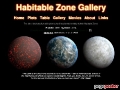 Submitted Jan 03, 2017 to Scientific Data The Habitable Zone (HZ) is defined as the range of circumstellar distances from a star within which a planet could have liquid water on its surface, given a dense enough atmosphere. This site is dedicated to tracking the orbits of exoplanets in relation to their Habitable Zones. The site is based upon the work of Stephen Kane and Dawn Gelino.
|
 Submitted Jan 03, 2017 to Scientific Data OpenTrials FDA, a project of the OpenTrials team, allows users to explore and discover FDA data. Find FDA Documents by drug name, text, and other keywords.
|
 Submitted Jan 03, 2017 to Scientific Data OpenTrials is a collaboration between Open Knowledge International and Dr Ben Goldacre from the University of Oxford DataLab. It aims to locate, match, and share all publicly accessible data and documents, on all trials conducted, on all medicines and other treatments, globally.
|
 Submitted Jan 02, 2017 to Scientific Data The Khipu Database Project began in the fall of 2002, with the goal of collecting all known information about khipu into one centralized repository. Having the data in digital form allows researchers to ask questions about khipu which up until now would have been very difficult, if not impossible, to answer. The Khipu Database Project was funded 2002-2004 by the National Science Foundation and Harvard University, and in 2004-2005 is funded by the National Science Foundation.
|
 Submitted Jan 01, 2017 to Scientific Data The IUCN Red List of Threatened Species is widely recognized as the most comprehensive, objective global approach for evaluating the conservation status of plant and animal species. From its small beginning, The IUCN Red List has grown in size and complexity and now plays an increasingly prominent role in guiding conservation activities of governments, NGOs and scientific institutions. To date more than 76,000 species have been assessed for The IUCN Red List.
|
 Submitted Jan 01, 2017 to Scientific Data The AmeriFlux network, established in 1996, provides continuous observations of ecosystem level exchanges of carbon dioxide, water, energy, and momentum spanning diurnal, synoptic, seasonal, and interannual time scales.
|
 Submitted Jan 01, 2017 to Scientific Data Since 1985, NOAA's Pacific Marine Environmental Laboratory (PMEL) and Atlantic Oceanic and Meteorological Laboratory (AOML) have been measuring atmospheric and surface sea water pCO2 on board the NOAA ships Oceanographer, Discoverer, Malcolm Baldrige, Ka'imimoana and Ron Brown. In addition, pCO2 measurements are made on vessels of opportunity ships (VOS) including the Columbus Waikato and Explorer. The methods are described in Wanninkhof and Thoning (1993) and Feely et al (1998). Select an ocean region to access underway pCO2 data
|
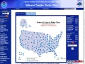 Submitted Jan 01, 2017 to Scientific Data To view a local radar, select area of interest and click on the map or find a local forecast by city, state, or zip code.
|
 Submitted Jan 01, 2017 to Scientific Data The National Oceanographic Data Center (NODC) manages the acquisition, ingest processing, quality control and long-term preservation of oceanographic data.The National Oceanographic Data Center holds global physical, chemical, and biological oceanographic data sets that are being used by researchers world-wide. Specifically NODC's Ocean Climate Laboratory is investigating interannual-to-decadal ocean climate variability using historical oceanographic data, and building scientifically, quality-controlled global oceanographic databases in their products known as the World Ocean Atlas and World Ocean Database. For a complete list of NODC data and products see our Access Data page. The data are scanned for viruses, and cryptographic checksums are generated and stored with the original data files so data integrity can be monitored and verified over extended time periods and across generations of storage technologies. A copy of the data is written to near-line mass storage and a copy is written to removable media for off-site storage.The NODC archive holdings include all the data acquired in its original form, as well as project and product files of data extractions.
|
 Submitted Jan 01, 2017 to Scientific Data The NAVDAT project is compiling existing age, chemical, and isotopic data from Late Cretaceous to Holocene extrusive and intrusive igneous rocks from the western United States, British Columbia, and northern Mexico into a web-accessible electronic database. NAVDAT will be integrated into a geographic information system (GIS) to allow visualization of complex age-compositional patterns in volcanism throughout the study region. The addition of necessary relational and graphical tools will allow users of the database to address a wide variety of issues concerning the geologic evolution and present volcanic state of western North America.
|
 Submitted Jan 01, 2017 to Scientific Data Providing data, tools, and community leadership for enhanced Earth-system education and research. Unidata provides a broad array of data to our community for use in many geoscientific applications. Unidata develops and supports tools that facilitate the analysis and visualization of geoscience data. Unidata is a diverse community of institutions vested in the common goal of sharing data, and tools to access and visualize that data.
|
 Submitted Jan 01, 2017 to Scientific Data ETI's World Biodiversity Database is a continuously growing taxonomic database and information system that aims at documenting all presently known species (about 1.7 million) and to make this important biological information worldwide accessible. Access to this online information system is free of charge for noncommercial use: scientific and educational purposes. All data in the WBD are copyright protected by the authors, artists and other contributors and may not copied or reproduced without approval of ETI and the lawful owners. The WBD is intended to increase understanding and to support a responsible use and to facilitate the management of the earths biodiversity resources. It is built as a joint effort of specialists worldwide who contribute basic taxonomic, ecological and biodiversity data to ETI to make this available in electronic form, both online in the WBD and in subsections on CD-ROMs.
|
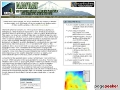
 Submitted Jan 01, 2017 to Scientific Data GTOPO30 is a global digital elevation model (DEM) with a horizontal grid spacing of 30 arc seconds (approximately 1 kilometer). GTOPO30 was derived from several raster and vector sources of topographic information. For easier distribution, GTOPO30 has been divided into tiles which can be selected from the map shown above. Detailed information on the characteristics of GTOPO30 including the data distribution format, the data sources, production methods, accuracy, and hints for users, is found in the GTOPO30 README file.
|
 Submitted Jan 01, 2017 to Scientific Data Find centroid moment tensor data for earthquakes. The main database runs from 1976 to the present. Formerly known as the Harvard CMT catalog.
|
 Submitted Jan 01, 2017 to Scientific Data PetDB is a data management and information system for geochemical and petrological data of igneous and metamorphic rocks from the ocean floor generated at spreading centers (mid-ocean ridges, back-arc basins, young near-axis seamounts, and old oceanic crust). PetDB contains all types of published analytical data measured on rocks, glasses, minerals, and melt inclusions (major and trace element data, stable and radiogenic isotope ratios, noble gas data, etc.). PetDB currently contains more than 700,000 chemical values for more than 30,000 rock samples from all of the Earths oceans.
|