
Earth Science
Earthquakes, Plate Tectonics, Volcanos, Environmental Science, Sustainable Development
110 listings
 Submitted Oct 30, 2004 to Science Research Groups » Earth Science The Hawaii Mapping Research Group of the University of Hawaii operates several seafloor mapping systems (the HAWAII MR 1 towed seafloor mapping sysstem, the IMI30 high resolution deep towed mapping system, the IMI12 imaging and mapping instrument), a seafloor map data archive (MR1, Arctic, and East Pacific Rise (EPR) archives), and provides data processing services for Kilo Moana multibeam systems and the WHOI DSL-120A deep towed mapping system.
|
 Submitted Oct 23, 2004 to Science Research Groups » Earth Science The Monterey Accelerated Research System (MARS) is a cabled-based observatory system, incorporating a benthic instrument node, AUVs, and various benthic and moored instrumentation. The MARS infrastructure will provide the capability to place and power instruments in areas of scientific interest in various geographical sites. This project will complete the design and then install an advanced cabled observatory in Monterey Bay that will serve as the test bed for a state-of-the-art regional ocean observatory, currently one component of the NSF Ocean Observatories Initiative (OOI). The Monterey Accelerated Research System (MARS) cabled observatory represents the next step toward harnessing the promise of new power and communication technologies to provide a remote, continuous, long-term, high-power, large-bandwidth infrastructure for multidisciplinary, in situ exploration, observation, and experimentation in the deep sea. MARS will be located in Monterey Bay offshore the Monterey Bay Aquarium Research Institute (MBARI).
|
 Submitted Oct 21, 2004 to Science Research Groups » Earth Science Dive and Discover is an interactive distance learning Web site designed to immerse you in the excitement of discovery and exploration of the deep seafloor. Dive and Discover brings you right on board a series of research cruises to the Pacific and Indian Oceans, and gives you access to the latest oceanographic and deep submergence research as it happens! Be at the front line of scientific inquiry and join scientists - geologists, geophysicists, chemists and biologists - who are exploring the seafloor and making amazing deep-sea discoveries. Daily updates, photos, videos, and e-mail correspondence with scientists aboard research vessels allow you to follow the progress of the scientific mission and find out about life on the floating laboratories at sea.
|
 Submitted Oct 20, 2004 to Science Research Groups » Earth Science The goal of the NEPTUNE project is to establish a regional ocean observatory in the northeast Pacific Ocean. The Projects 3,000-km network of fiber-optic/power cables will encircle and cross the Juan de Fuca tectonic plate in the northeast Pacific Ocean, an area roughly 500 km by 1,000 km in size. Approximately 25 experimental sites will be established at nodes along the cable. These sites will be instrumented to interact with physical, chemical, and biological phenomena that operate across multiple scales of space and time. Sensor networks will fill in the volume between nodes and will include multipurpose robotic underwater vehicles that will reside at depth, recharge at nodes, and respond to events such as submarine volcanic eruptions. Via the Internet, the network will provide real-time information and command-and-control capabilities to shore-based users.
|
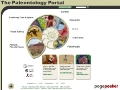 Submitted Oct 16, 2004 to Science Research Groups » Earth Science This site is a resource for anyone interested in paleontology, from the professional in the lab to the interested amateur scouting for fossils to the student in any classroom. We have gathered many different resources into this single entry "portal" to paleontological information on the Internet. Images and links that you see as you browse through the site have been reviewed and selected for quality by one or more members of the Editorial Board. This site was produced by the University of California Museum of Paleontology, the Paleontological Society, the Society of Vertebrate Paleontology, and the United States Geological Survey. The site was funded by the National Science Foundation.
|
 Submitted Oct 15, 2004 to Science Research Groups » Earth Science Although renowned for more than 50 years of pioneering ocean research the world over, the scientists of Columbia University's Lamont-Doherty Earth Observatory have always maintained a keen interest in their own backyard - the Hudson River and Estuary. In fact, one of the first major projects undertaken at Lamont involved using the newly created tools of seismology to survey the riverbed prior to construction of the Tappan Zee Bridge in the early 1950s. Since then, a steady stream of Columbia research has delved into a wide range of river issues - from sediment transport to PCB contamination to carbon and nutrient cycles to the myriad effects of global climate change. Over the last 15 years in particular, the breadth and pace of Hudson River research at Columbia has accelerated in step with the ever-increasing development pressures born of an economic boom and a burgeoning population. With no fewer than the six major research initiatives currently underway within the Hudson River watershed, Columbia is striving to create a knowledge base that will enable more effective long-term management of this vital natural resource.
|
 Submitted Oct 14, 2004 to Science Research Groups » Earth Science An Initiative of the Global Leaders for Tomorrow Environment Task Force, World Economic Forum. The Environmental Sustainability Index (ESI) is a measure of overall progress towards environmental sustainability, developed for 142 countries. The ESI scores are based upon a set of 20 core "indicators," each of which combines two to eight variables for a total of 68 underlying variables. The ESI permits cross-national comparisons of environmental progress in a systematic and quantitative fashion. It represents a first step towards a more analytically driven approach to environmental decisionmaking. The documents made available here provide in-depth details on the analytical framework, quantitative methodology, and data sources that underlie the ESI .
|
 Submitted Oct 13, 2004 to Science Research Groups » Earth Science The Hawaiian Volcano Observatory (HVO) enjoys a world-wide reputation as a leader in the study of active volcanism. Due to their usually benign natures, Kilauea and Mauna Loa, the most active volcanoes on the Island of Hawai`i, can be studied up close in relative safety. While observations made by 19th-century missionaries and travelers constitute a large part of the early and colorful history of volcano watching in Hawai`i, HVO's origins are rooted in a desire to use scientific methodology to understand the nature of volcanic processes and to reduce their risks to society. Kilauea, Mauna Loa, Hualalai, Haleakala, Loihi. Eruption update. Current activity. Current earthquakes. Hazards.
|
 Submitted Oct 13, 2004 to Science Research Groups » Earth Science Seismic Monitor allows you to monitor global earthquakes in near real-time, visit seismic stations around the world, and search the web for earthquake or region-related information. You can also view seismograms and make dataset requests via its WILBER interface.
|
 Submitted Oct 13, 2004 to Science Research Groups » Earth Science The Incorporated Research Institutions for Seismology is a university research consortium dedicated to exploring the Earth's interior through the collection and distribution of seismographic data. IRIS programs contribute to scholarly research, education, earthquake hazard mitigation, and the verification of a Comprehensive Test Ban Treaty. Support for IRIS comes from the National Science Foundation, other federal agencies, universities, and private foundations.
|
 Submitted Oct 13, 2004 to Science Research Groups » Earth Science The PASSCAL Instrument Center is located on the New Mexico Tech campus in Socorro New Mexico. We are an NSF sponsored facility whose purpose is to provide modern, state-of-the art equipment to do field research in seismology. The facility is comprised of 14 full time staff, part time student workers and interns. The support we provide is in the form of seismic instrumentation, maintenance of equipment, training and logistical field support for experiments.
|
 Submitted Oct 13, 2004 to Science Research Groups » Earth Science Scripps Institution of Oceanography is one of the oldest, largest, and most important centers for marine science research, graduate training, and public service in the world. Scripps Institution was founded in 1903 as an independent biological research laboratory, which became part of the University of California in 1912. At that time the laboratory was given the Scripps name in recognition of supporters Ellen Browning Scripps and E. W. Scripps. Scripps staff numbers approximately 1,300, including about 90 faculty, nearly 300 other scientists, and some 200 graduate students. The institution's annual expenditures total more than $140 million. Research at Scripps encompasses physical, chemical, biological, geological, and geophysical studies of the oceans. Ongoing investigations include the topography and composition of the ocean bottom, waves and currents, and the flow and interchange of matter between seawater and the ocean bottom or the atmosphere. Scripps's research ships are used in these investigations throughout the world's oceans.
|
 Submitted Oct 13, 2004 to Science Research Groups » Earth Science Through hundreds of research projects, the Earth Institute brings its strengths from climate prediction to integrated water management, biodiversity conservation to public health, geophysics to hazards reduction to bear on the challenges of environmental decision-making, international development programs, and science policy to greatly improve conditions for the world's poor while preserving the natural systems that support life on Earth.
|
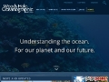 Submitted Oct 13, 2004 to Science Research Groups » Earth Science Woods Hole Oceanographic Institution is a private, non-profit research facility dedicated to the study of marine science and to the education of marine scientists. It is the largest independent oceanographic institution in the world.
|
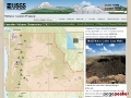
 Submitted Oct 11, 2004 to Science Research Groups » Earth Science The Pacific Northwest Seismograph Network. All about earthquakes and geologic hazards of the Pacific Northwest
Latest Quakes. Volcanoes. Catalogs & Data. Hazards & Preparation. Research. Outreach & Education. Operations & Projects. REPORT AN EARTHQUAKE. USGS EQhazard. Mount Adams. Mount Baker. Crater Lake. Glacier Peak. Mount Hood. Mount Rainier. Mount St. Helens. Three Sisters. Mount St. Helens Seismicity Information. Cascade Volcano Locations and 4,000 year Eruption Summary. |
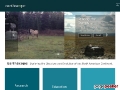
 Submitted Oct 11, 2004 to Science Research Groups » Earth Science The volcano camera shows an image of Mount St. Helens, taken from the Johnston Ridge Observatory. The Observatory and VolcanoCam are located at an elevation of approximately 4,500 feet, about five miles from the volcano. The view is approximately south-southeast across the North Fork Toutle River Valley. The image automatically updates approximately every five minutes. We expanded the VolcanoCam Images Archives include three VolcanoCam movies! You are now able to download and view the Mount St. Helens eruptions of October 1, October 4 and October 5, 2004. We also have available complete sets of the individual images (from dawn to dusk) of these three days.
|
 Submitted Oct 11, 2004 to Science Research Groups » Earth Science News and information on the Cascades Volcanoes with links to new publications, current information, photos, maps, links, plus brief eruptive history of each volcano. Includes updates on the current status of the Cascade Range Volcanoes including Mount St. Helens. World-wide current volcanic activity. Hazads assessment reports and maps. Educational materials for students and teachers. America's volcanic past. What to do if a volcano erupts. Information and Maps to the Cascade Range. Travel and Hiking Information. Links to other Agencies. National Parks, Volcanic Monuments, and National Forests.
|
 Submitted Oct 10, 2004 to Science Research Groups » Earth Science Welcome to the South Pacific Odyssey, a scientific quest to understand a part of the deep sea called the Lau Basin. Enveloped by the territorial waters of the Kingdom of Tonga, the journey to the Lau Basinrich in mystery and intrigueseeks answers to questions, simple and complex: What forces shape the dramatic landscapes that characterize this ocean basin? Why is the seafloor here different from any other place on Earth? What bizarre life forms exist at these deep-sea hot springs? How can life exist in such extreme conditions, and what can we learn from it? Throughout this site, you will explore the Lau Basin; meet the scientists; catch glimpses of the rich culture, customs and traditions of the people of this region; and journey alongside as scientists lock their sights on a target spot. Only then will they begin to unravel the mysteries, one by one, map by map, rock by rock, animal by animal.
|
 Submitted Oct 09, 2004 to Science Research Groups » Earth Science InterRidge is an initiative concerned with facilitating international and multi-disciplinary research associated with mid-ocean ridges. The InterRidge Office is hosted by the Leibniz-Institut fr Meereswissenschaften for the next threeyear term - from 2004 to 2006. Representatives from the Member Nations form the Steering Committee, which plans and directs InterRidge activities. Working Groups are established by the Steering Committee to oversee development and execution of various aspects of the In terRidge program. The scientific objectives of InterRidge are outlined in the Science Plan. The National Correspondents, are a vital component of InterRidge, representing the main nodes of communication between InterRidge and participating countries.
|
 Submitted Oct 09, 2004 to Science Research Groups » Earth Science EarthScope is a bold undertaking to apply modern observational, analytical and telecommunications technologies to investigate the structure and evolution of the North American continent and the physical processes controlling earthquakes and volcanic eruptions. EarthScope will provide a foundation for fundamental and applied research throughout the United States that will contribute to the mitigation of risks from geological hazards, the development of natural resources, and the publics understanding of the dynamic Earth.
|